
More than 130 years ago, the Phoenix skyline featured barely any buildings taller than a few stories. Glancing at old photos, only the surrounding mountains look familiar.
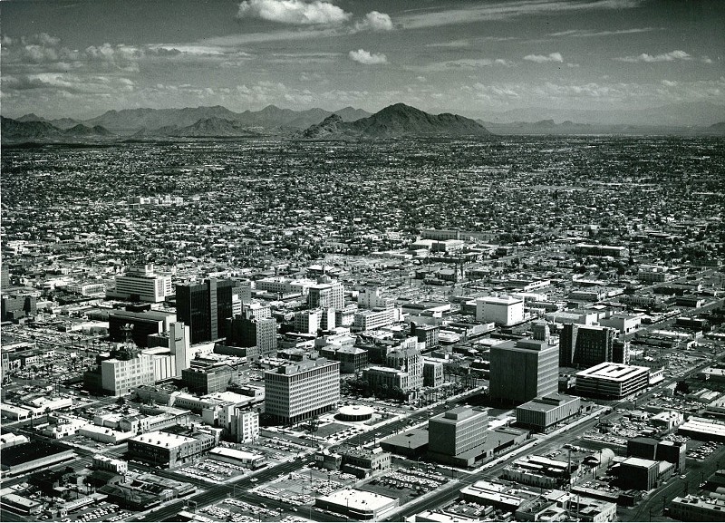
But as the population of Phoenix grew — from roughly 100,000 in 1950 to about 1.6 million people today — so has the look of downtown. Though some remain, many older stone and brick buildings were razed and replaced by taller and taller skyscrapers. Two major sports facilities, Footprint Center and Chase Field, were constructed.
With construction cranes dotting the downtown landscape, expect the complexion of the city's center to look even more different a few years from now. Until then, take a walk through history with these photos of the Phoenix skyline through the decades.
1800s

The Monihon Building at First Avenue and Washington Street in Phoenix was built in 1889.
Tempe History Museum
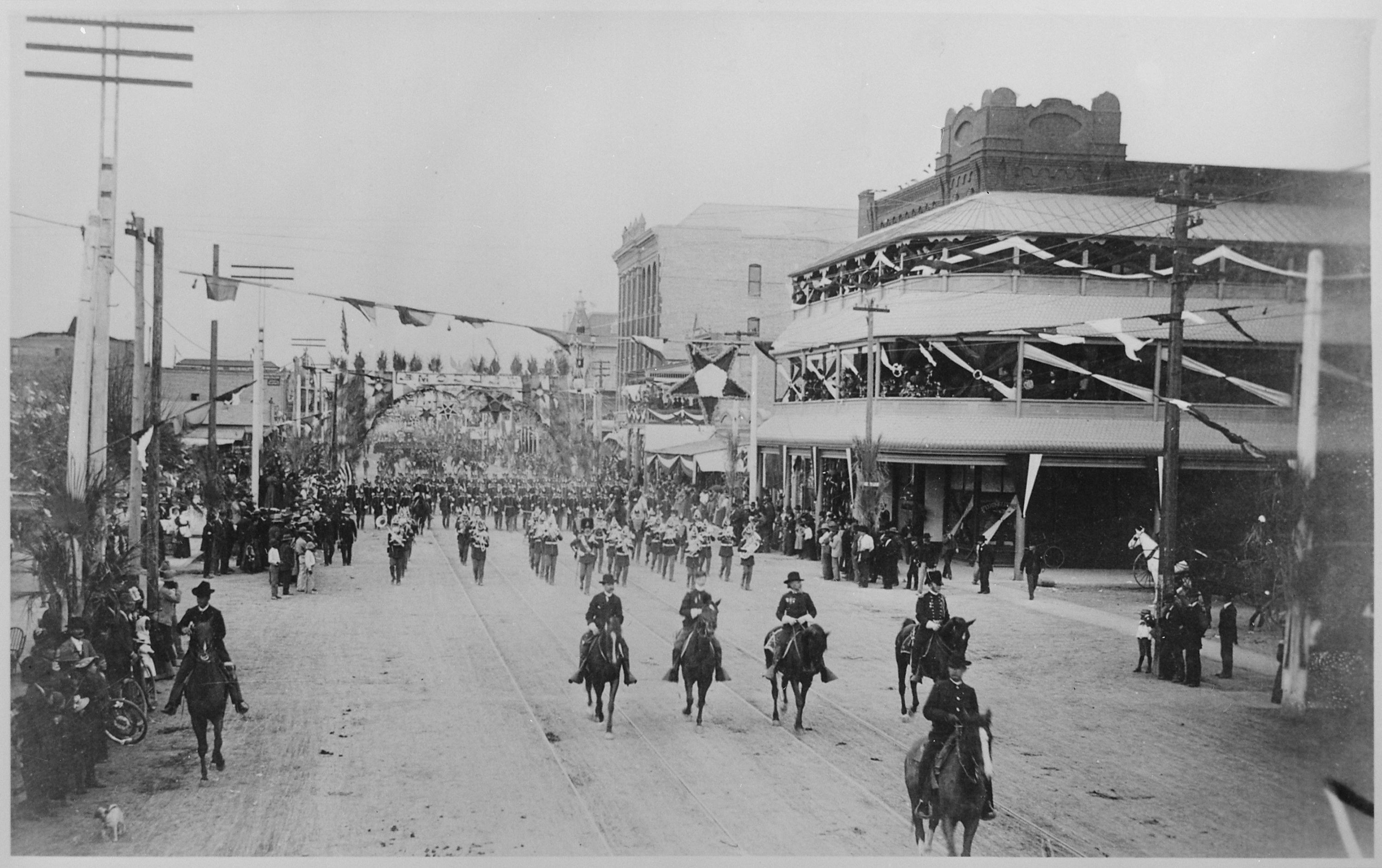
A military parade heads down a Phoenix street — though it's not clear which one — in 1888. At this point, the city's population was about 3,000.
1900s

The Monihon Building in Phoenix around 1900.
Stephen C. Shadegg Papers/Greater Arizona Collection/Arizona State University Library

Bicycle riders and a horse-drawn carriage roll down a Phoenix street in the 1900s.
Mesa Historical Museum
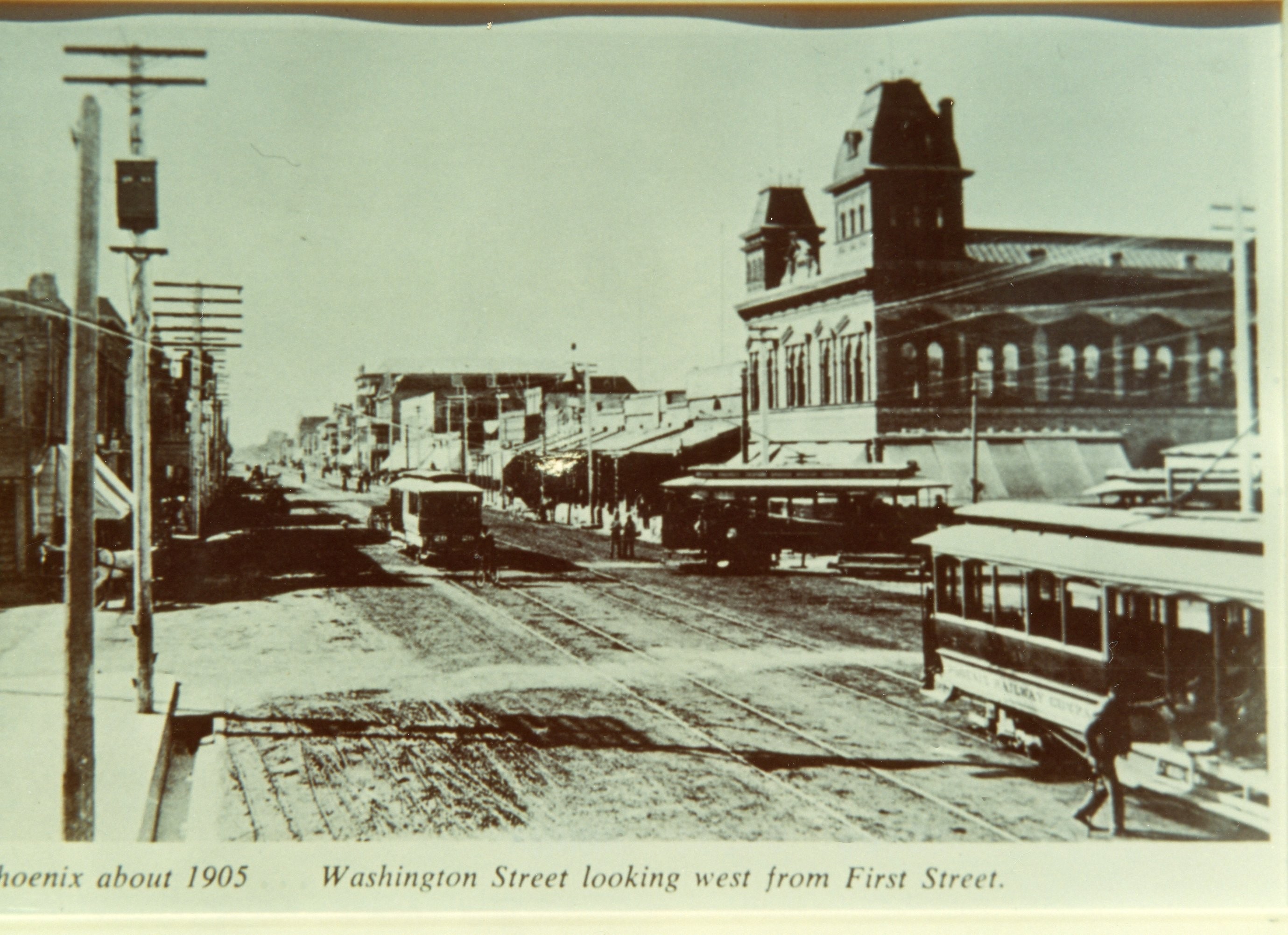
This photo from 1905 shows Washington Street looking west from First Street. You can see the Monihon Building on the right in the distance, while streetcars move up and down the street.
1920s
Phoenix in the 1920s.
Arizona Historical Society/Tucson General Photo Collection/TU PC 1000/Places-Phoenix-General/100328
1930s

Phoenix in 1933.
McCulloch Brothers Photographs/Herb and Dorothy McLaughlin Collection/Greater Arizona Collection/Arizona State University Library
Luhrs Tower, built in 1929 at 11 W. Jefferson St., now features Bitter & Twisted Cocktail Parlour and Monroe's Hot Chicken on the ground floor.
Of note in this 1935 photo: Ray Busey Paints, located at Second and Van Buren streets. Busey was an important civic figure in Phoenix, going on to serve as mayor from 1946 to 1947.

1940s
Phoenix in 1946.
McCulloch Brothers Photographs/Herb and Dorothy McLaughlin Collection/Greater Arizona Collection/Arizona State University Library

Phoenix in 1946.
McCulloch Brothers Photographs/Herb and Dorothy McLaughlin Collection/Greater Arizona Collection/Arizona State University Library
1950s

Phoenix circa 1950.
Stephen C. Shadegg Papers/Greater Arizona Collection/Arizona State University Library
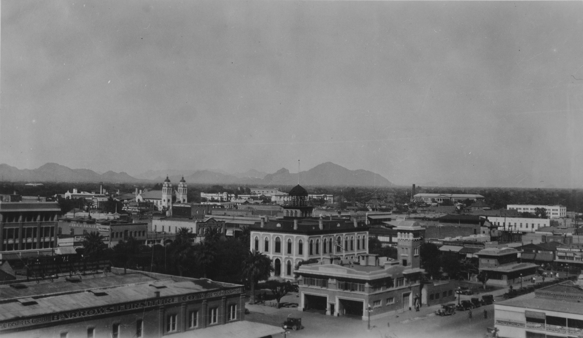
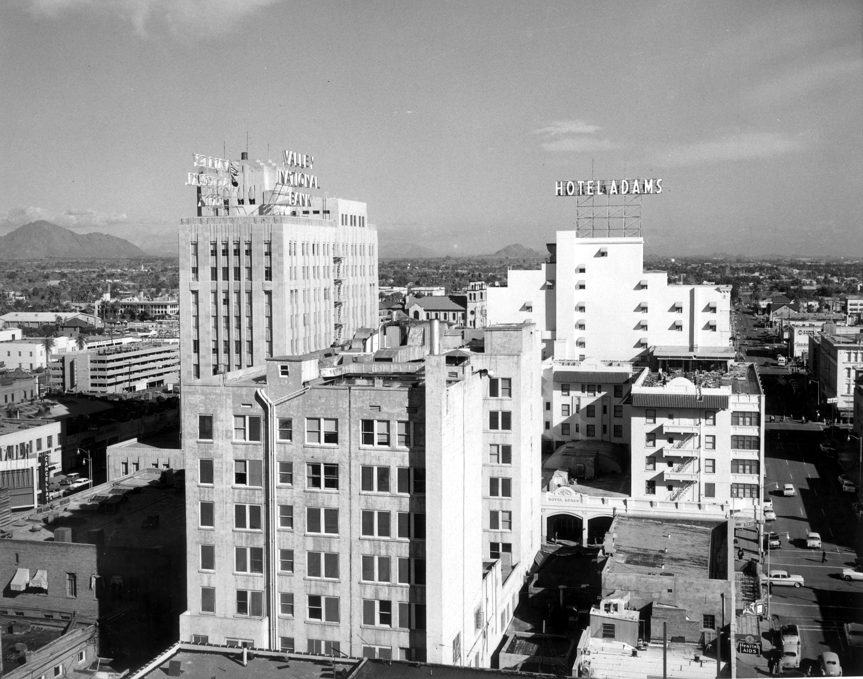
Also taken in 1950, this photo shows the Professional Building — see the Valley National Bank sign now on the roof — as well as the Hotel Adams, which was torn down and rebuilt in 1973. It's now the Renaissance Phoenix Downtown Hotel.
1960s

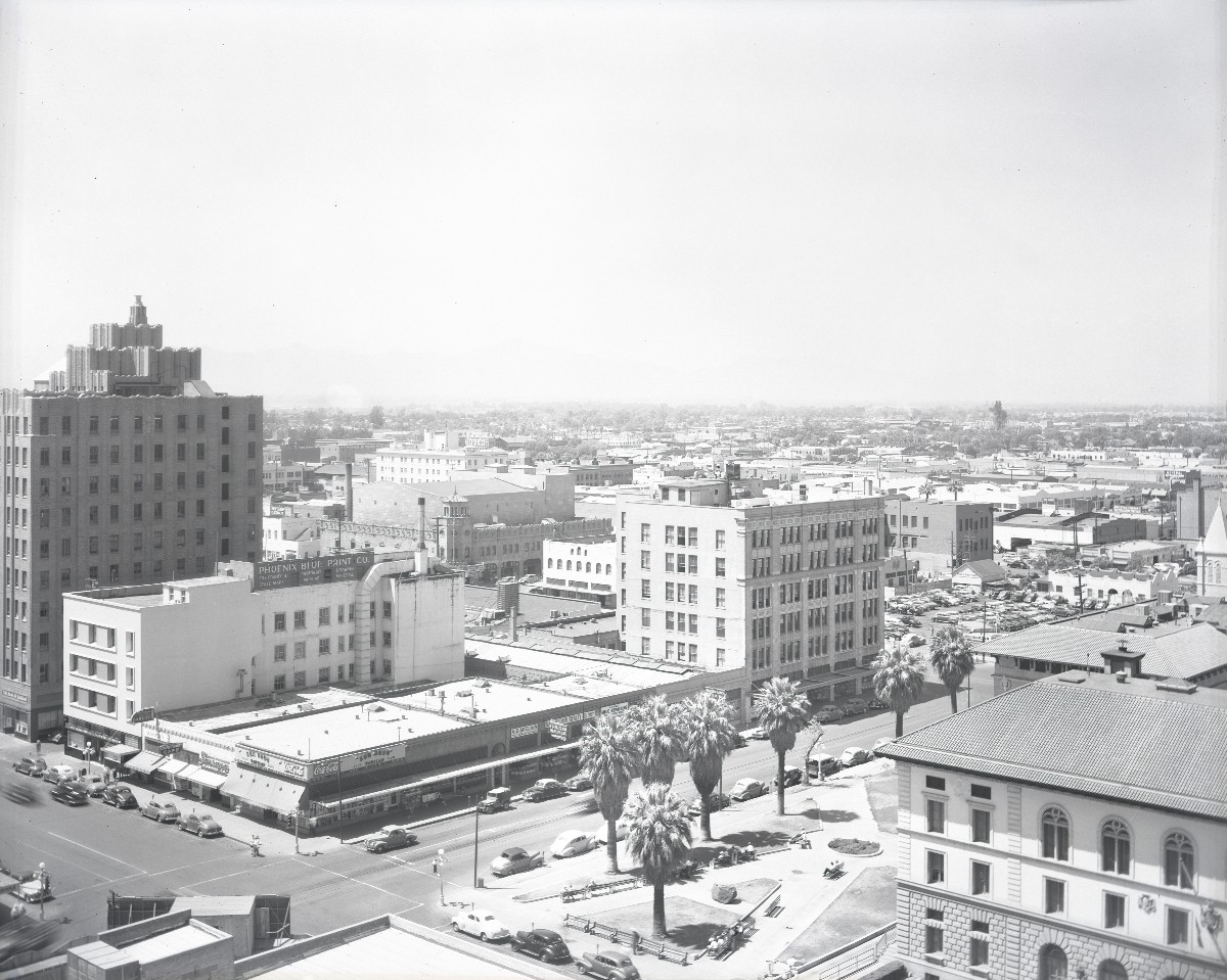
Phoenix in 1965.
Stephen C. Shadegg Papers/Greater Arizona Collection/Arizona State University Library

Phoenix in 1969.
Stephen C. Shadegg Papers/Greater Arizona Collection/Arizona State University Library
1970s
In this 1973 photo, you can see the Valley National Bank building — now with rotating sign — next to a brand-new glass facade tower constructed the year before. Initially owned by Valley National Bank, the structure was renamed Chase Tower — as we know it today — following a series of corporate takeovers and mergers.
1980s
Whoa, color photos! In this 1985 shot, Chase Tower is framed on the right by St. Mary's Basilica and on the left by the Hyatt Regency Hotel, which was completed in 1976.
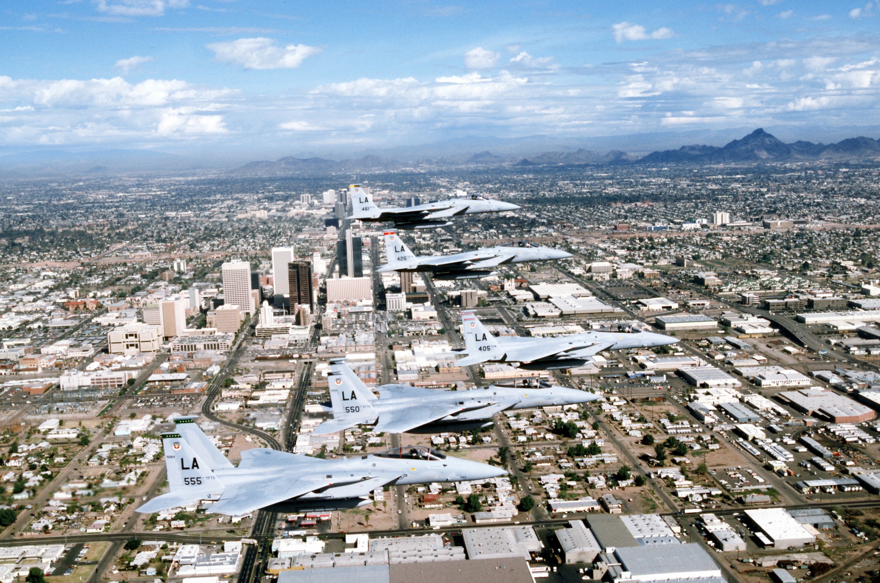
A military flyover of downtown Phoenix in 1987.
Courtesy National Archives, photo no. 330-CFD-DF-ST-99-06066
1990s

A practice race for the United States Grand Prix in Phoenix in 1991.
Pascal Rondeau/Allsport/Getty Images
2000s
Phoenix in 2005.
Garry Wilmore/Flickr/CC BY-NC-SA 2.0
2010s
We get our first glimpse of what's now known as Footprint Center at the far lower-right of the frame in this 2011 photo, even though the building was constructed in 1992. First known as America West Arena, the home of the Phoenix Suns was known as the US Airways Center at the time of this shot.
Phoenix in 2012.
Alan Stark/Flickr/CC BY-SA 2.0
2020s
Phoenix in 2022.
[email protected]/Flickr/CC BY 2.0
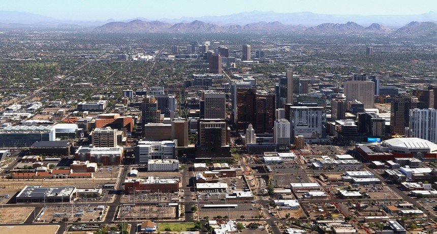
Phoenix in 2022 — basically as it is today.
Nestled in the middle is Luhrs Tower. When it was finished in 1924, it was the tallest building in Phoenix. A century later, it's dwarfed by the bigger — and glitzier — skyscrapers that now dominate the Phoenix skyline, a signpost of how much the city has grown.