On July 2, researchers at NASA's Jet Propulsion Laboratory released an image showing road and sidewalk temperatures around Phoenix reaching as hot a 160 degrees one day last June. The image, with visuals from satellite imagery and data from an instrument aboard the International Space Station, shows the state of the Phoenix streets at 1:02 p.m. on June 19. The air temperature at that time was only 106.
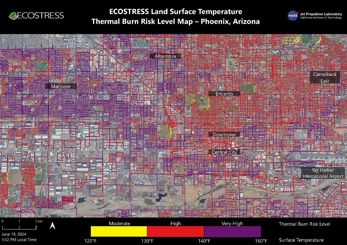
A data visualization from NASA showing Phoenix streets registering anywhere between 120 and 160 degrees one day in June.
NASA/JPL-Caltech
Pavement on much of the west side of town, particularly Maryvale, was dangerously hot — between 140 and 160 degrees. Temperatures were relatively cooler in Encanto and Camelback East, both of which have more green spaces. That's not a coincidence.
“We create these maps to be intuitive to users and help make data more accessible to the public and citizens scientists,” said Glynn Hulley, a JPL climate researcher. “We see them as a vital tool for planning effective heat interventions, such as tree planting, that can cool down the hottest roads and sidewalks.”
Urban sprawl and a lack of green spaces make heat worse. According to NASA, "asphalt absorbs up to 95% of solar radiation" and can be 40-60 degrees hotter than the air temperature on hot days. That makes those surfaces particularly perilous. NASA said surfaces that reach even 120 degrees — those small yellow patches on that map — are hot enough to "cause contact burns in minutes to seconds."
The data for the NASA visualization was provided by an instrument called ECOSTRESS, which stands for the Ecosystem Spaceborne Thermal Radiometer Experiment on Space Station. (We love a reverse-engineered acronym, don't we?) Launched in 2018, ECOSTRESS primarily is used to measure plants’ thresholds for water use and water stress in a warming climate. Unfortunately, Phoenix doesn't have that many plants to measure.
Maybe if the Valley had more, it wouldn't be so horrifically hot.